Community Environment
King tides a rising threat in Gig Harbor
Gig Harbor’s Midway School, a lovingly restored one-room schoolhouse built in 1893 and relocated to the Harbor History Museum on an oversized truck in 2009, is due for another change. This time it’s thanks mainly to rising sea levels and higher, stronger king tides that inundate the harbor shoreline several times a year.
The folks at the museum aren’t building an Ark just yet, but they are getting ready for changes ahead.
The venerable, 129-year-old school building’s next move won’t require a mega-truck, Harbor History Museum Executive Director Stephanie Lile said. The move will be strictly vertical.
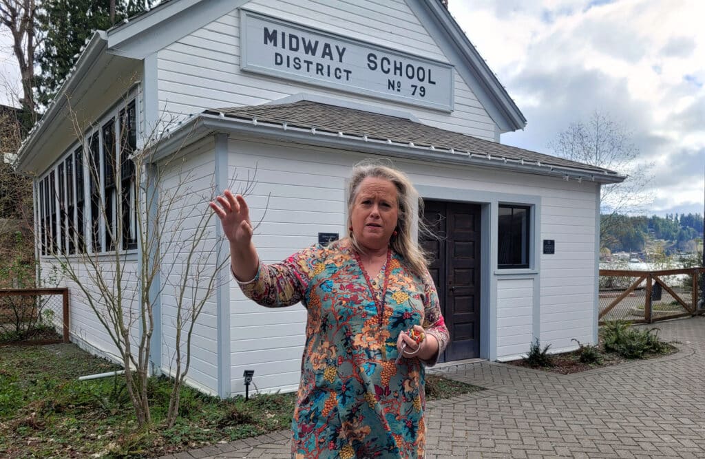
Harbor History Museum Executive Director Stephanie Lile discusses king tides in front of the Midway School building at the museum on March 30, 2022. The museum plans to raise the school building to protect it from future king tides.
The wooden building’s foundations need to be raised by as much as two feet to protect the city’s sole surviving one-room schoolhouse — last used to teach readin’, writin’ and ’rithmatic in 1941 — from moisture under the building, heavy rainfall during powerful storms and rising tides.
High and dry
The cozy schoolhouse is a long-time favorite of students, teachers and parents.
Museum visitors are drawn to period details such as tiny elementary school desks with inkwells and a vintage blackboard. A mounted video screen plays interviews with locals who attended the school as children.
After its foundation is lifted, the school, nestled on a hillock above Donkey Creek, will be higher, drier, safer.
The museum’s modern main building, opened in 2010, will undergo climate-driven mitigation work, too, Lile said. That entails enclosing the museum’s Maritime Gallery, an appropriately water-facing space where the fishing boat Shenandoah is being painstakingly restored.
The planned enclosure is designed to protect the vessel, built in 1925 by Gig Harbor’s Skansie Boat Building Co., from an unholy trinity of strong winds, heavy rain and surging king tides.
“Our goal is to start construction by September,’’ Lile said.
Shenandoah shelter
Right now, most of the Maritime Gallery is temporarily draped in dark wind-and-weather screening. A long, unblocked opening runs parallel to the Shenandoah.
“The weather and wind are always beating on it,’’ Lile explained. “We hung (the screen) to shield the boat from the rain and snow that blows all fall, winter and spring. It helps, a lot.’’
The red board-and batten siding used outside the museum building at 4121 Harborview Drive will wrap around the back. The open spaces will become big glass windows with UV filters.
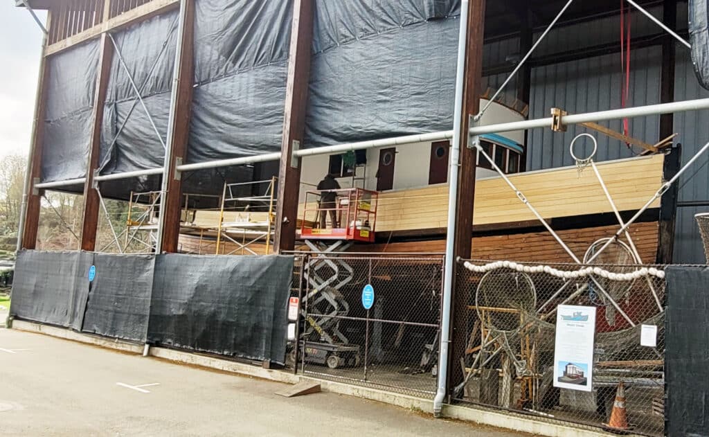
Work continues on the fishing boat Shenandoah inside the Maritime Gallery at Harbor History Museum in Gig Harbor. The museum plans to enclose the gallery to protect the Shenandoah from the conditions, including possible king tides.
It’s big job that requires time and money. The estimated completion date for the Maritime Gallery is sometime in 2025, the Shenandoah’s centennial year. The schoolhouse lift shouldn’t take as long.
Even as climate adjustments get underway, the museum is in the midst of a “10-year plan for the future of the museum campus,’’ Lile said. Museum planners are monitoring the local tides, with an eye to where the high water mark could be by 2050. Their goal is to preserve and protect the museum in the coming decades.
For now, “if there is a really, really high king tide, the Maritime Gallery would be flooded,’’ Lile said. Shipwright Riley Hall, working on the Shenandoah nearby, added, “floating debris is the big problem in flooding.’’
King tides are no picnic
All these adjustments are driven by a delicate minuet in the heavens. The University of Washington’s King Tides Program explains it this way:
“These already higher-than-average tides are exacerbated when spring tides coincide with the moon in perigee, which means the moon is particularly close to Earth. … The perigee happens at the same time as a spring tide …creating the most common type of king tide, a perigee spring tide.’’
“We use the picnic table in the park as our visual marker,” Lile said, “and it has been at table-top height a number of times in the last five years.’’
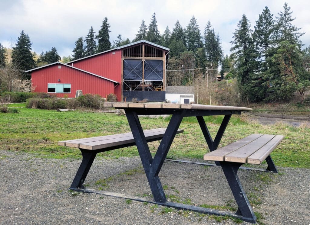
This park bench, in Austin Park just south of the Harbor History Museum, has been nearly submerged by King tides several times in the past few years.
Other waterside locales in Gig Harbor have seen similar sights. Skansie Brothers Park was flooded when powerful storms and 14-foot king tides drenched parts of the city on Jan. 7. Downtown restaurant Netshed No. 9 briefly but photogenically took on water before customer service was restored 90 minutes later.
Those king tides, which typically muscle into the narrow, funnel-shaped harbor in December and January, inspired binge-worthy galleries of online photographs.
Indeed, the impact of radically high tides is being felt more and more.Governments, businesses, transportation planners, homeowners and community institutions like the Harbor History Museum are compelled to adapt to a new normal.
‘These events have really been growing’
This trend will intensify, according to environmental experts at the National Oceanic and Atmospheric Administration (NOAA) in Washington, D.C.
“King tides have been embraced by many citizen science groups and are used to track high-tide flooding in their community,” said Jennie Lyons, director of public affairs for NOAA’s National Ocean Service.
NOAA’s Dr. William Sweet, an oceanographer specializing in sea level rise, emphasized that “we’ve always had these tides, but there’s more flooding now.’’ The high tides and floods are not usually imminent dangers to human life, but they have caused increasingly extensive and expensive damage to buildings, roads and other infrastructure in recent years.
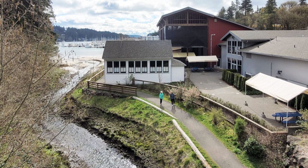
Donkey Creek empties into Gig Harbor next to the Harbor History Museum. The worst flooding occurs with a combination of king tides, heavy rainfall and snow runoff causing Donkey Creek to rise.
Sweet, who has studied climate at NOAA for 15 years, said scientists began seeing accelerating change back in 2008-09. “Since that time these events have really been growing.’’
To learn about the changing effects of rising seas is to appreciate how complex and far-reaching they are. Sweet, who lives in Annapolis, Md., home of the U.S. Naval Academy, has done research for the military, which wants to know what sea-level rise and extreme weather holds in store for national security.
“We looked at all coastal installations worldwide,’’ Sweet recalls. NOAA sketched out “scenarios that help them plan. Another factor is risk management for base commanders around the world.’’
Threat greater on East Coast
More broadly, NOAA, which has studied tides for more than 100 years, focuses on gathering and updating rainfall statistics for the National Weather Service.
The idea is to build more systematic metrics for computer models to enhance weather forecasts and alert the public when climate-related trouble approaches. This helps communities that need to evacuate residents or close off streets and enhances public safety. It also helps communities frame their budgeting and allocation of assets, Sweet says.
The threat is greater in some areas than others, Sweet emphasizes. The East Coast sees the most adverse effects, because “the East Coast has a strong tidal system.’’ Major ports such as Boston, New York City and Miami are located in flat, low-lying areas.
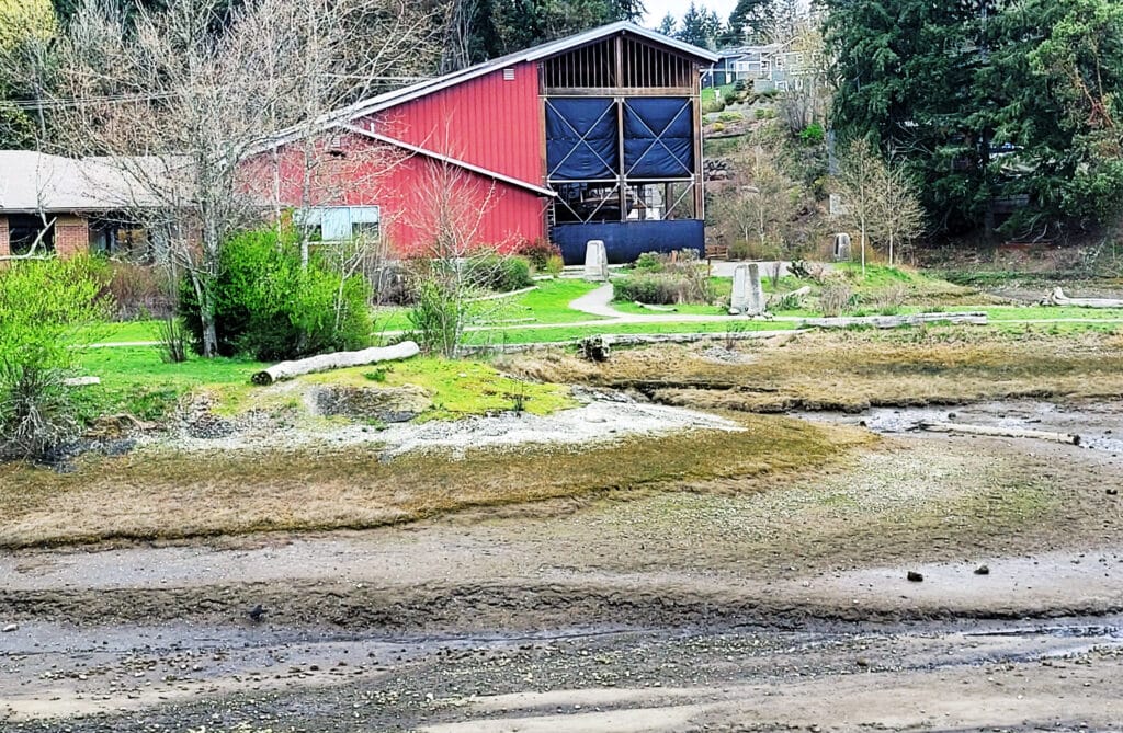
The Harbor History Museum during a recent low tide. During king tides, the water can reach high enough to threaten the building. Vince Dice
Some Eastern seaports and cities were built-up and expanded by using normally soggy landfill. In short, they’re flood-prone.
“Washington state is relatively stable outside of tectonic movement,’’ Sweet says, so “the ocean is not rising as quickly’’ here or elsewhere on the West Coast.
NOAA’s tracks rising tides on its online Tides and Currents map. The Tides and Currents station map for your area can be found here.
UW’s King Tides Program
Climate scientists in Washington state help localize the issues in granular detail. One such expert is Bridget Trosin, a coastal policy specialist at the University of Washington’s College of the Environment. She coordinates the Washington King Tides Program at UW.
“I’ve been here for 10 years, and with the King Tides Program for probably nine years,’’ the Bellingham native says. “I cover the whole coast and Puget Sound.’’
Trosin sees her job as similar to the NOAA’s mission to study, educate and inform, but on a local and regional level.
“King tides are something that happens naturally,” Trosin said. “Spring tides happen during our winter and we see storms then, which can cause flooding and damage. We address how communities can prepare, what we can do about it.’’
Trosin said that Puget Sound is strongly tidal. “There are certain areas of Puget Sound that flood repeatedly. In West Seattle, the stairs going down to the Sound are covered by water.’’
King tide parties
Trosin’s underlying messaging is serious but she tries to make it fun. It’s a distinctive touch in a scientific field of study that can get technical fast and become, umm, a little dry.

Gig Harbor Police captured this scene during a king tide at Skansie Brothers Park in January 2022.
“I’m sometimes asked to deliver a talk by, let’s say, a yacht club. They’ll say, ‘Can you give a talk on king tides?’ I say ‘Sure.’ And I’ll often reach out and say, “Hey, I’d like to host a king tides party. It’s super-casual. I bring coffee and donuts.’ They tend to occur early in the morning, when the tides are running strong. People have to get up when it’s dark, and wait till it’s light enough to see the photos.’’
King tides party people take a lot of photos, and that’s where the fun becomes useful. Trosin encourages people around the state to take photos of local landmarks when powerful king tides roll in, then send some to MyCoast, which tracks such tides. The images help environmental researchers map and measure the effects of very high tides, she said.
Waterside Washingtonians can track when king tides are predicted through the King Tides Program’s online calendar.

