Arts & Entertainment Community
Two In Tow & On The Go | You could own this lot for just $9,999 (but it’s mostly underwater)

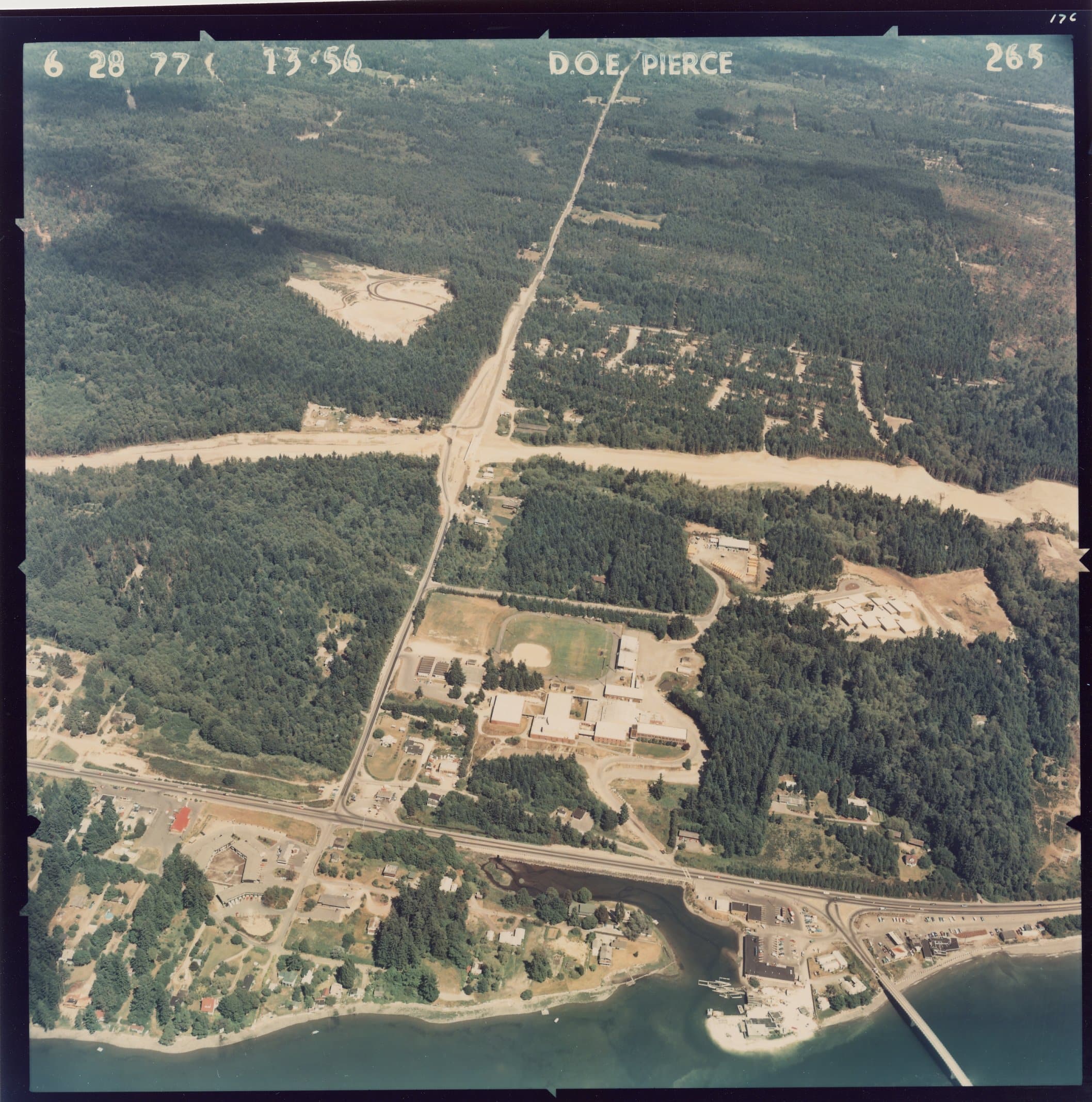
“0 Tyee Dr NW Unit XXXX, Gig Harbor” is located just north of the Purdy Bridge behind the shopping center.
Today’s column takes a slightly different direction as I lead you away from kid destinations and into an odd mix of land-use rules, tideland law and dashed beachy dreams. But we’re not going that far — just north to where Purdy Creek empties into the Burley Lagoon.
Arts & Entertainment Sponsor
Arts & Entertainment stories are made possible in part by the Gig Harbor Film Festival, a proud sponsor of Gig Harbor Now.
Unfortunately, this specific destination isn’t public property, so you can’t pack up the kids and head there for a winter beach walk.
Not yet, anyway.
Because, if the price is right, you could soon own it.
That was definitely my first thought when I tapped on the little red price bubble of curiosity a couple months ago to see what the oddly placed zeros and Xs in “0 Tyee Dr NW Unit XXXX, Gig Harbor” were all about.
For sale is a 3,520-square-foot triangular-shaped waterfront lot, located behind the shopping center before the Purdy Bridge. The land appears to have old dock pilings still in the water. The zoning is listed as “NURBSENS” (find my guesses about what that awesomeness is below). According to the listing, the seller inherited the property and doesn’t have detailed information about the land uses. He’s selling it “as-is.”
The asking price
My first introduction to the site was the low-low asking-price of $15,000 — already cut in half from its $29,000 market debut in summer 2024. Then, just after Christmas 2024, the price dropped to $9,999, which is still active as of Friday Jan. 10, 2025. Coming from the California coast and now Gig Harbor, that $10K price tag for land, especially fronting the water, is easily the cheapest I’ve seen in the last decade.
So, for a split second, or, you know, for a whole column’s worth of brainstorming sessions and an afternoon site visit with my super awesome history pal Greg Spadoni, I may have let my imagination run a little bit wild on just what a mom and two kids could do with such a parcel-icious purchase all of their own. (OK, ok, we’d invite Bowen too) 🙂
-
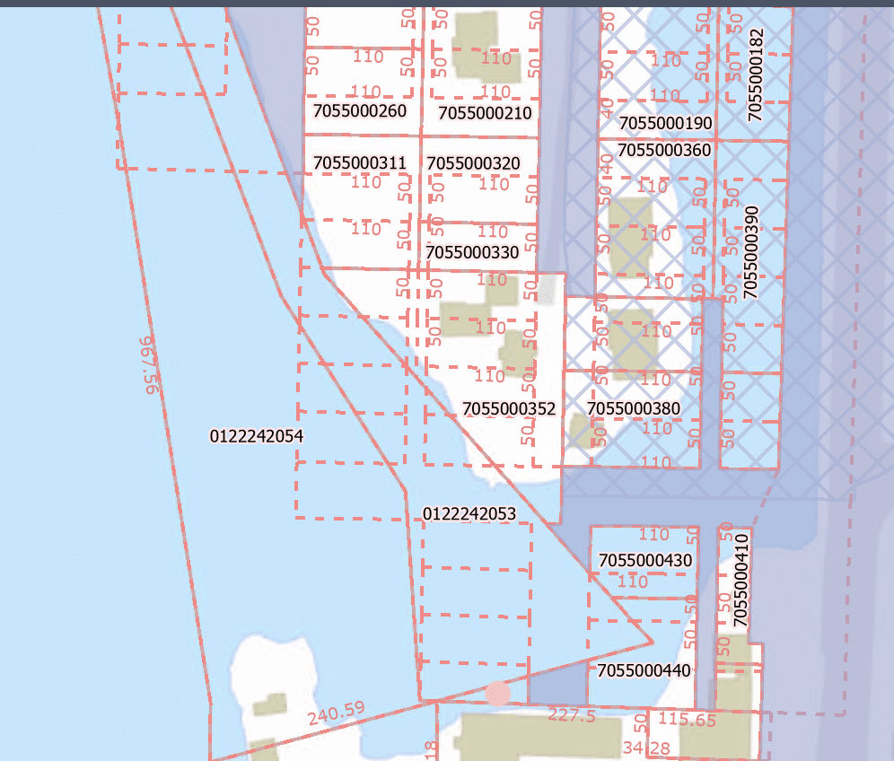
- PublicGIS web map for Pierce County showing plot lines.
-
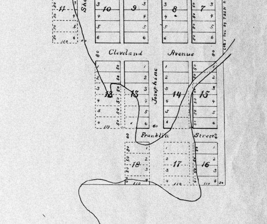
- Purdy Plat; Pierce County

Standing on the lot overlooking Purdy Creek as it opens into Burley Lagoon.
Day dreaming
Because … our own private beach? Heck yes! Excuse me while I daydream about setting up some sling-back chairs at the water’s edge to soak up mid-afternoon sunsets*. The kids and I could skip rocks across the water’s glassy top and wave hello to the much-debated Taylor Shellfish geoduck property since its storage/support lot is a direct neighbor.
No matter how small or oddly triangle-shaped the random little waterfront lot is, it’s priced to sell (although it’s been on the market awhile — and I don’t know all the legal or liability issues there).
“NURBSENS”
Yes, this curious no-address Tyee Drive NW lot has a lot of unknowns. Its legal description says it involves “Lots 3 & 4, Block 18, Plat of Purdy, Pierce County, W.T., except that portion lying below the meander line,” according to the Pierce County Assessor-Treasurer’s office. That bit about the meander line is what land surveyors use to determine property boundaries involving bodies of water.
Meanwhile, the lot’s real estate listing has phrases like “the seller, who inherited the property, lacks detailed information about it” and “buyers should verify all zoning classifications, potential uses, and requirements independently,” suggesting that either no one has fully investigated this piece of land or they’re deliberately passing the responsibility to the buyer. Although … I now have quite a bit of info on the parcel — as does our Gig Harbor Now history columnist who shares a few surprises about the lot’s past — in a link below.
But, before we get there, I gotta talk about “NURBSENS” – a “phrase” included in the listing that’s now officially my new favorite word.

When you see NURBSENS pop up in a real estate listing, it sounds like the best geeky made-up word ever (and definitely the name of a future pet). But my guess is it’s funny presentation is just a quirky result of the local multiple listing service (MLS) database squishing together a county abbreviation for zoning. With a little brainstorming and some Googling, it seems like “NURBSENS” could stand for something like “Non Urban Sensitive” or even “North Urban Sensitive.”
Digging deeper, Pierce County actually has a zoning designation called the Urban Sensitive Resource Overlay (USRO). This zoning is all about protecting natural features like valleys, stream corridors, and habitats while preserving the area’s wooded character and water quality. It emphasizes community open space and low-impact development techniques to keep the environment intact. That makes sense for a lot along the shores of the Burley Lagoon. So while “NURBSENS” might look like a typo or some wacky made-up language, it likely points to a zoning classification meant to safeguard natural resources.
I’m still using it to name a future pet, though.
A lot that’s complicated
With the cheapest asking price for land in miles, a real estate listing like this makes you pause and wonder, “What’s the catch?”
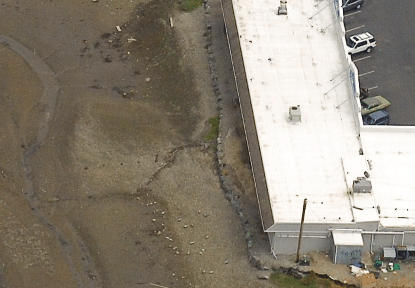
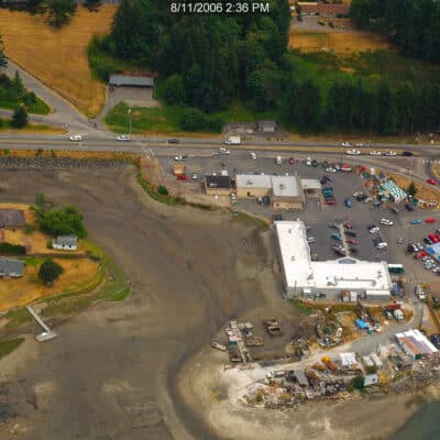
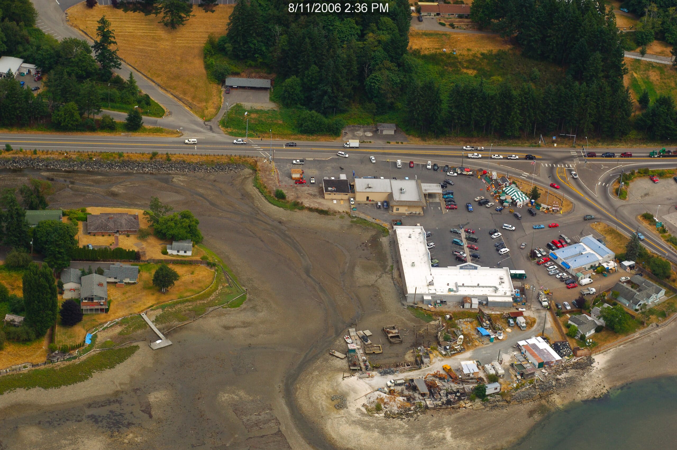
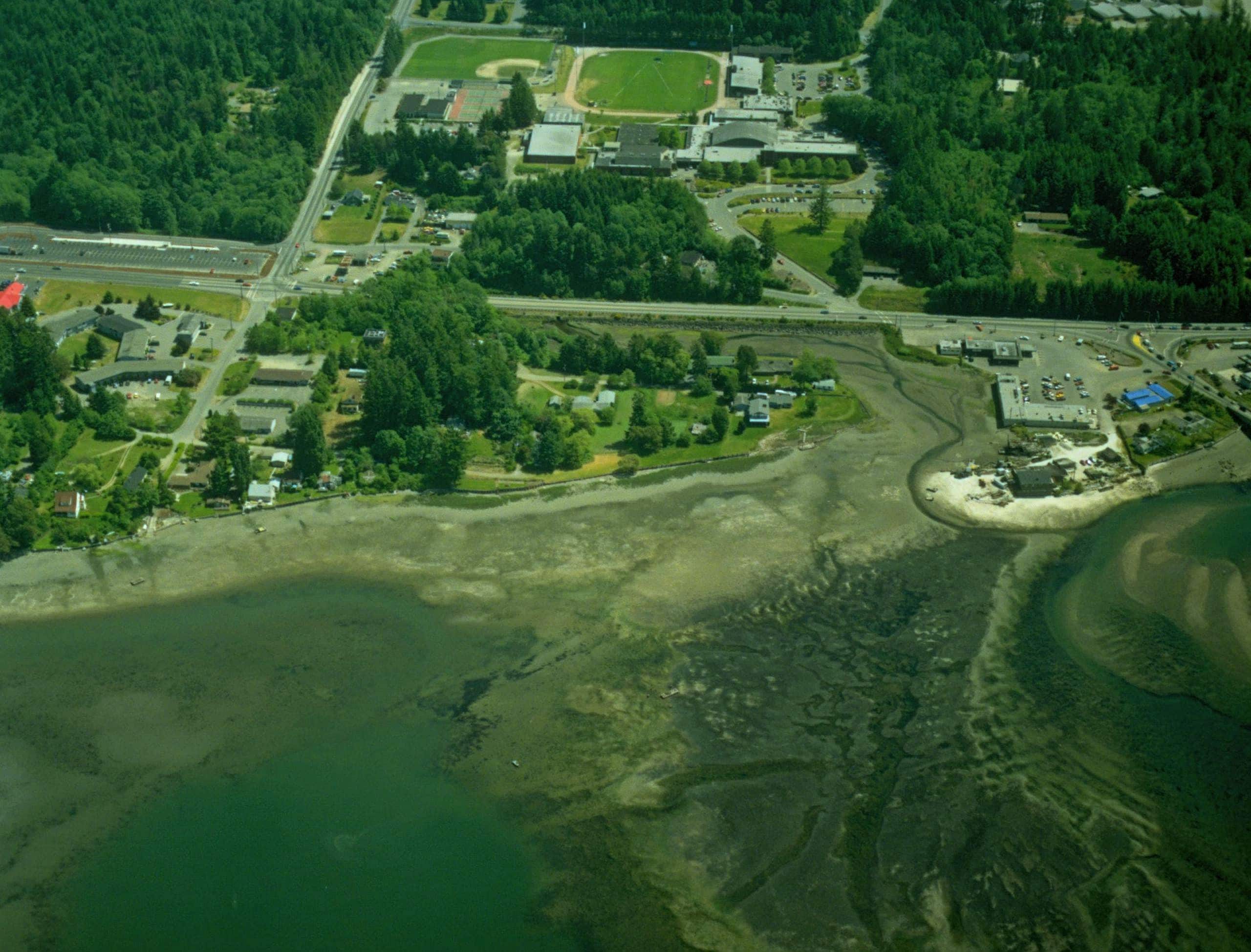
As it turns out, there is, at least, one small snag … most of this lot is, um, underwater. No, it’s not part of a bankruptcy. It’s quite literally below the waterline. But, not all the time. Here’s a bird’s eye view of the parcel using the state’s shoreline snaps over the decades:
-
- 2006 closeup, Washington State Coastal Atlas Aerial Photo Series
-
- 2006, Washington State Coastal Atlas Aerial Photo Series
-
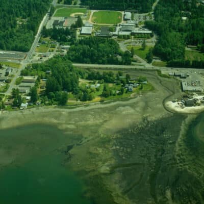
- 1990, Washington State Coastal Atlas Aerial Photo Series
-
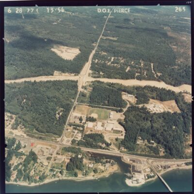
- 1970, Washington State Coastal Atlas Aerial Photo Series
In the Plat of Purdy, dated March 16, 1885, some of the lots are drawn with solid lines and others with dotted lines. The dotted, or dashed, lots appear to indicate that those specific parcels are sometimes covered in water, depending on the tide. I checked with local resident and retired land surveyor Clark Rowland to be sure. Clark volunteers at the Harbor History Museum’s Resource Room for research projects.
“My interpretation of the solid heavy lines is that they are an attempt to show where the top of a bank or the line of mean high tide was located at the time of the preparation of the plat map. The solid lot lines appear to me to be lot lines above the line of mean high tide. The dashed lot lines appear to show the portion of the lots covered by tides,” he said in an email to me.

Harbor History Museum copy of the Purdy Plat
Now, some of you may be thinking “I know what that lot is then! It’s a historic tidelands lot!” I wish. Because that was my first thought, too, since I’d never seen tidelands for sale before. But, alas, I don’t think tidelands lots and underwater lots are the same thing, land-use wise, as “tidelands” may involve deeper waters than the other. But, again, I’m no expert on these things.
Greg explained tidelands law to me once before, with info I think he got from Clark, since Clark knows all the cool technical stuff about land boundaries.
Greg’s rundown went something like this:
When Washington became a state in 1889, it drew up land sites to homestead or sell to the people for private use, but claimed ownership of all tidelands and shorelands (lands under navigable waters) for itself. That meant there was public use of all water for navigation, fishing, and recreation. Later, the state sold off some tidelands to private owners to encourage development, aquaculture, and economic growth.
As a result, the tidelands of today are a mix of private and public ownership, the latter of which is managed by the Washington Department of Natural Resources. The different ownerships make for some unique situations, like public beaches that are tough to reach without a boat. Often times, the beach/shoreline is public but the land in which to access it (to park on and walk to the beach through) on is private property where trespassing is illegal.
Greg’s History Story
Greg found (or already knew) plenty of information about the Purdy plat and this specific lot. Read on for his side of the story (and some funny observations about our underwater lot).
*PNW winter joke.
Ps. If anyone puts an offer on “0 Tyee Dr NW Unit XXXX, Gig Harbor” or buys it outright, let me know!
Tonya Strickland is a Gig Harbor mom-of-two and longtime journalist. Now in the travel and family niche, her blog, Two in Tow & On the Go, was named among the 10 Seattle-Area Instagram Accounts to Follow by ParentMap magazine. Tonya and her husband Bowen moved to Gig Harbor from California with their two kids, Clara (10) and Wyatt (8) in 2021. Find them on Facebook for all the kid-friendly places in and around town.