Arts & Entertainment Community
Day Tripper | A first exposure to the TV-famous town of Roslyn
Somehow, I managed to miss nearly everything iconic about turn-of-the-century TV. In those days, I was a working fool, and if I wasn’t working, I would hang out with friends. There was precious little time for TV viewing, and if I did record and watch something, it was most likely a prime-time drama like LA Law or NYPD Blue. Frasier was the one comedic exception. I’m guessing I’m one of a handful of people in America who had a TV but never watched a single episode of Seinfeld.
A little AK right here in WA
I kept hearing from California friends about this great show filmed near where I lived in Washington. I wasn’t curious enough to inquire further then, but once I retired and came home in 2010, I asked my kids about it. At first, they were puzzled, but finally realized I was talking about the award-winning Northern Exposure, filmed in Roslyn between 1990 and 1995.
My son explained that the show is actually set in the fictional town of Cicely, Alaska. The concept of Cicely is loosely based on the real town of Talkeetna, approximately 113 miles north of Anchorage. The show’s producers chose Roslyn as a Lower 48 stand-in due to its uncanny resemblance to what they thought an Alaskan locale might look lkike — and because of its geography, historical relevance and climate.
Visiting Roslyn is really pushing the Day Tripper 100-mile limit. From the Gig Harbor side of the Narrows Bridge to the Roslyn/Salmon La Sac exit (Exit 80 – Bullfrog Road) on I-90, it is exactly 99.5 miles. Getting to the actual village of Roslyn is another 3 miles. But let’s not split hairs. It’s worth that extra little bit to visit the town and learn more about the history of the site that so enjoyed its 5 years of fame.
This is a great time of year to push our limits. Just a few days past the summer solstice, you can pretty much count on 14-16 hours of daylight driving time and fairly decent weather (I inadvertently picked a day with intermittent spring showers to make my visit). With snowfalls like those in Talkeetna, should you choose to go in the winter, you may want to consider cheating a bit and making it a 2-day trip.
Roslyn looks a lot like Cicely
While all the exterior location filming for Northern Exposure was in Roslyn, inside shoots (such as of the interior of The Brick Tavern and Dr. Fleischman’s home and office) were filmed in a studio in Redmond.
I’m not quite sure what my expectations were, but they weren’t quite met. That’s not good or bad, and I’m not even sure exactly what I was anticipating. I just know I didn’t find it. Roslyn really hasn’t changed much in three decades.
Locals seem to pretty much be over the commercialization of their community. There are, of course, a smattering of souvenirs in the Second Street stores. And several of the iconic symbols of the show have clearly been maintained. But it is easier to learn about the history of the railroads and mining industry than about the TV show that put Roslyn on the map. (I’m not saying that’s a bad thing!)
Still, there’s plenty to check out in Roslyn. For one thing, the outside of The Brick doesn’t look any different than it did 30 years ago.
The Brick Tavern
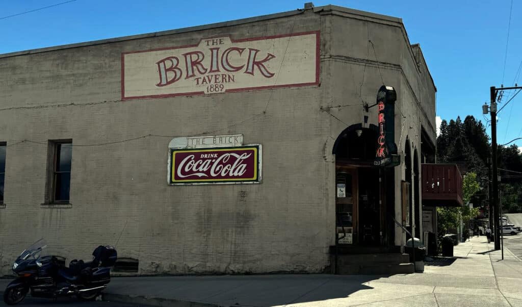
Roslyn’s best-known tavern.
The Brick is the oldest continuously-operating tavern in Washington state. It was constructed in 1889 using 45,000 bricks, resulting in its name. An underground tunnel leads to the local bordello. It also features a beautiful backbar that was shipped from England and purchased in Oregon, and a huge spittoon with a 23-inch stream of running water.
Roslyn Cafe
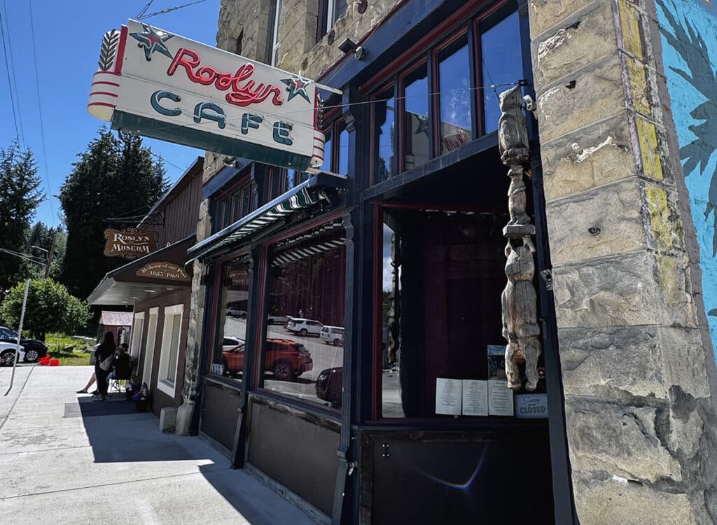
The Roslyn Cafe
The Roslyn Café was regularly featured in the series. Several other local businesses don’t look like they’ve changed much over the past three decades. Both the grocery store and barbershop look just as they were depicted in the show.
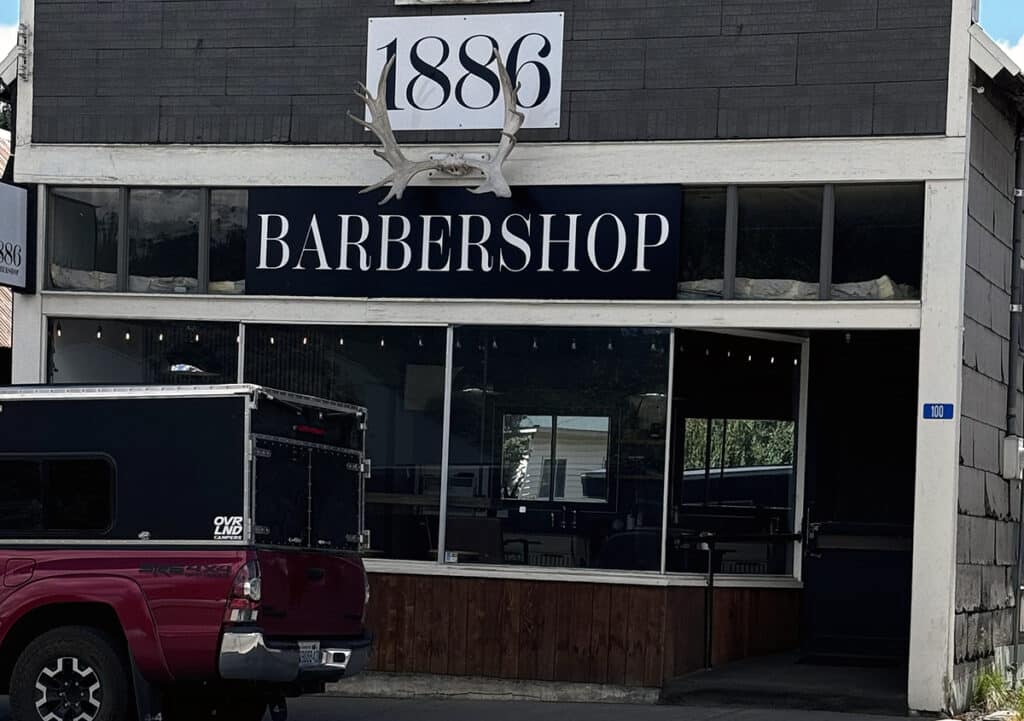
This should look familiar to people who watched Northern Exposure.
Roslyn Museum
Like most towns, no matter how small, Rosyln is home to a historical museum. Located at 203 W. Pennsylvania Ave., the museum’s summer hours are 11 a.m. to 3 p.m. Friday through Tuesday (closed Wednesday and Thursday). There is no fee, but they ask for a donation of at least $2 per person. A map in the museum shows how to find the primary filming sites around town.
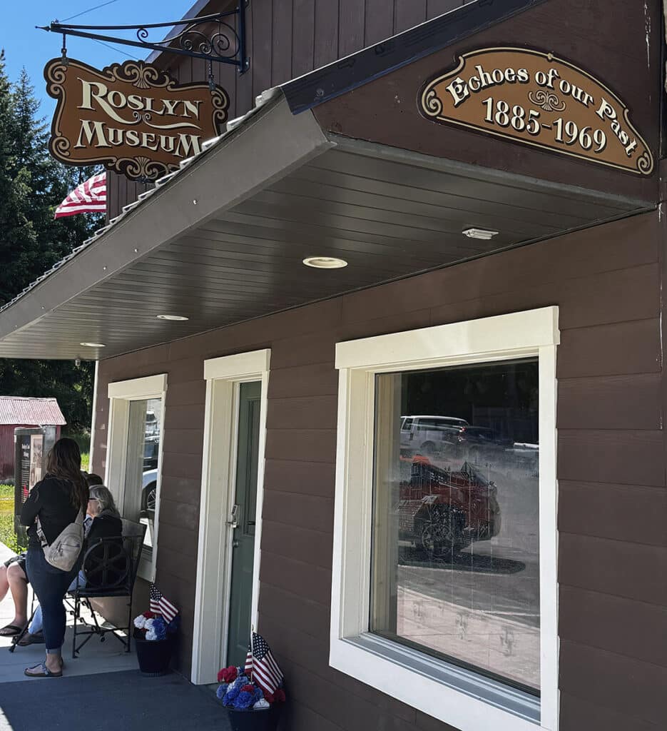
You can find a map to Northern Exposure filming locations here.
One of the most recognizable is the Roslyn Café mural on the corner of Pennsylvania Avenue and Second Street. The mural, which predates the series, was modified in editing to make it Roslyn’s Café. (If you want to hear the whole explanation, watch the first episode of the first season, streaming on Prime Video). It depicts the moose which strolls through town in the opening of each episode, although a member of my family (who shall remain nameless) thought for 30 years that it was a camel. After looking more closely at the mural, and considering the caption, I’m not so sure he’s wrong.
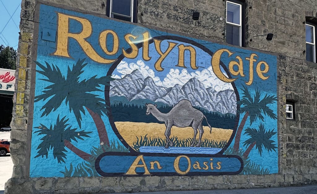
Definitely not a camel.
Moosefest
For many years, Northern Exposure aficionados gathered each year for Moosefest, a Northern Exposure fan festival. Scheduled for the last weekend in July, it included events and appearances by actors.
Over the 30 years since the show ended, attendance has dwindled to 15-30 people. Despite renewed interest in Northern Exposure due to Prime Video, the organizers have decided to discontinue the formal activities and replace them with an informal Moosefest.
Anyone interested in attending the more casual celebration is welcome to participate. For more information, check out the Moosefest website.
Buried History
If you are a devotee of old cemeteries and the history they represent, you may want to stop at the Roslyn Cemetery nestled in the hills above the town. A survey of the tombstones, many of which are very ornate, reflects the rich ethnic mix that originally settled in Roslyn. Some 28 sections are separated by nationality. Reading the various epitaphs provides insight into the many tragedies that befell a small mining town including mining accidents, epidemics, and war.
Mining for Coal
As I’ve wandered through Western Washington, I’ve learned that much of our area owes its late 19th and early 20th century prosperity to the combination of lumber and railroads. The extensive coal fields in the area around Roslyn fueled the Northern Pacific Railroad’s trains during construction and early operation of a direct rail line through the Cascades. Incorporated in 1886, Roslyn played an important role in this era of Washington state history. Just down the street from The Brick is another beautiful brick wall honoring the miners that originally settled the area.
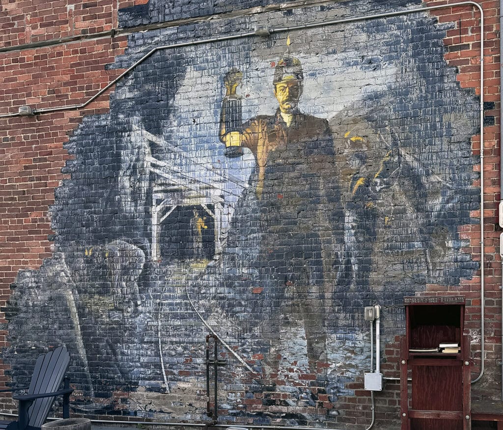
Miners were key to the development of the town of Roslyn.
The museum and its website feature a map of the historic Coal Mines Trail. Covering a total distance of 5.5 miles, the trail runs from South Cle Elum to Ronald, about 1.9 miles northwest of Roslyn.
The trail starts at South Cle Elum (keep reading for more information). If you are looking for a shorter hike, park next to the museum in Roslyn. It’s a central starting point if you’re looking for short round-trip hikes of about 4 miles. If you actually decide to go during the winter, several reports on the Washington Trails Association website (wta.org) indicate that it’s a great trail for easy snowshoeing.
A history lesson, an iconic village, and snowshoeing. What more could one ask for?
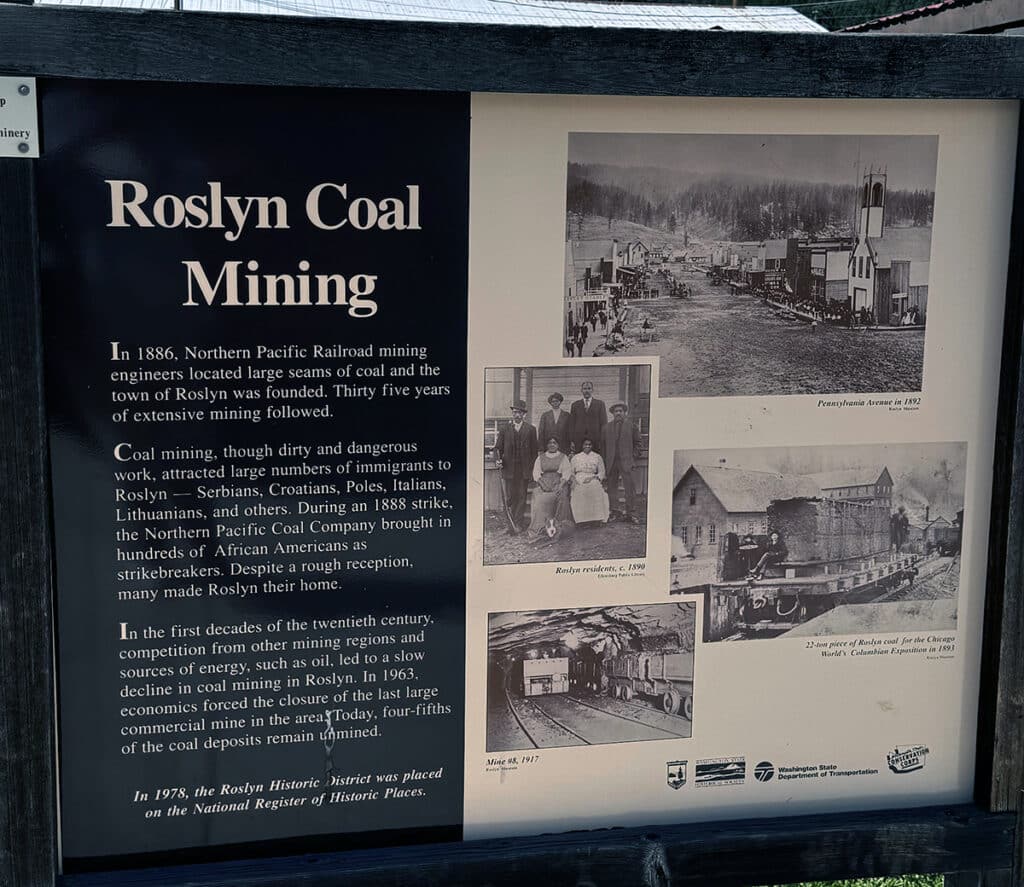
A sign explaining how central coal mining was in the early days of Roslyn.
Really pushing it
It would surprise no one to learn that I’m pretty experienced at pushing my limits. I figured it was silly to be at Roslyn and not travel the additional three miles to check out the area surrounding the South Cle Elum Rail Yard, and a couple of access points to the Cascades to Palouse Trail and Iron Horse State Park. From there, it only seemed reasonable to check out downtown Cle Elum, particularly the Telephone Museum.
South Cle Elum Rail Yard
In 1906, the Milwaukee Road Railway Company decided it must expand into the Northwest if it was to remain competitive. Construction was begun on the Pacific Extension, which was further extended to Tacoma in 1909. As part of the work, they constructed a rail yard in South Cle Elum. At the yard, locomotives were serviced, train crews came on and off duty, and train cars were sorted and stored. A depot and station were added in order to load and unload passengers or freight. Traveling east, South Cle Elum was the stop between Tacoma and the next division point at Othello.
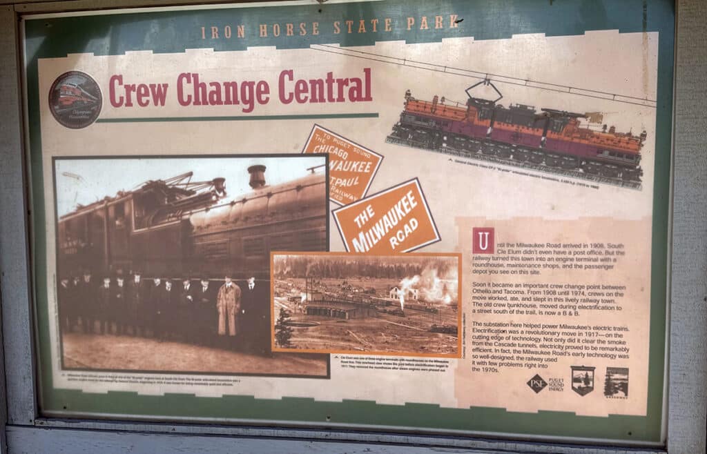
Iron Horse State Park near Cle Elum.
The rail yard consisted of the depot, the roundhouse, the turntable, ash pit, water tank, and a bunkhouse where train crews got some rest between shifts. In 1920, an electric substation and operators’ residences were also built. Most of the buildings have now succumbed to decay, but the depot still stands.
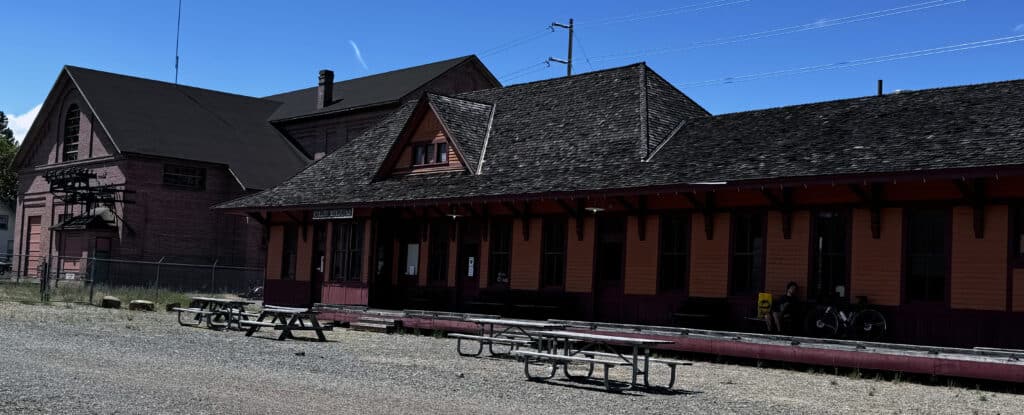
The depot at the rail yard in South Cle Elum.
By 1980, the Milwaukee Road ceased operation in Washington and sold off much of its property. Ownership of the main line and infrastructure were transferred to the state. As in so many other regions, the DNR took over the property and created a trail. Initially named the John Wayne Pioneer Trail, the DNR transferred ownership to the State Parks and Recreation Commission. In 2018, the trail was renamed the Palouse to Cascades State Park Trail.
The depot remains and is now a museum. The rail yard and associated buildings were listed in the National Register of Historic Places in 2003.
Iron Horse State Park
Iron Horse State Park is a 1,612-acre park located in the Cascades and Yakima River Valley between Cedar Falls on the west and the Columbia River on the east. It is located within the former right of way of the Milwaukee Road and is home to a segment of the Palouse to Cascades State Park Trail. It shares a trailhead at South Cle Elum with the trail and is adjacent to the Rail Yard Depot.
Palouse to Cascades State Park Trail
The Palouse to Cascades State Park Trail is a 289-mile long trail running from Cedar Falls near North Bend to the Washington-Idaho border. The trail was originally part of the railroad line which was decommissioned in 1980. It is now part of the Great American Rail-Trail which enables cross-country travel by foot or by bike from coast to coast, a distance of nearly 4,000 miles. The trail runs between the two Washingtons: Washington, D.C., and Washington state.
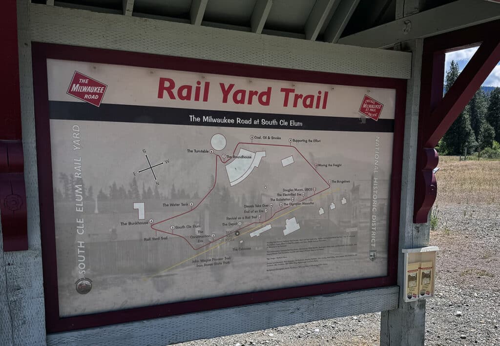
Trails at the old rail yard in South Cle Elum.
The area between Cle Elum and Roslyn was once known as the John Wayne Pioneer Trail. It is also part of the Mountains to Sound Greenway, a 1.5-million-acre landscape surrounding I-90 between Seattle and Ellensburg.
Both the Bullfrog and South Cle Elum exits, about 4 miles apart (exits 80 and 84 off I-90), have trailheads with restroom facilities (read that port-a-pottys) and parking.
Telephone Museum
In September of 1966, Cle Elum was the last town in the Pacific Northwest Bell service area of Washington, Oregon, and Northern Idaho to install rotary dial phones. (Seattle, on the other hand, first got dial phones in 1924). Until then, nearly every call into or out of Cle Elum had to be originated or completed with the assistance of an operator plugging and unplugging switchboard wires. To honor this event, Northwest Bell donated the switchboard building and equipment illustrating the development of telephone technology from 1876 to 1970 to the community Historical Society. The museum is located at 221 E. 1st Street.
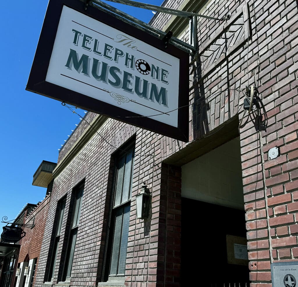
A museum honoring the days when phones didn’t fit in your front pocket.
The museum is posted as open from noon to 4 p.m., Memorial Day through Labor Day. When I visited (on a Sunday) a sign on the door said it was open Tuesday through Thursday only. Check the museum’s website for more information if you plan to visit.
Teanaway Community Forest
Teanaway Community Forest is way out of our range — at least another 10 miles beyond Cle Elum, too much of a push even for me. Still, it’s too close for me to not tell you a bit about it so you can make your own decision.
TCF is Washington State’s first community forest. The state Department of Natural Resources, Washington Department of Fish and Wildlife and a community-based advisory committee manage the area. Created by long-ago geologic events, it includes Roslyn Formation Sandstone, Teanaway Basalt, and rare Ellensburg Blue agate. It is the only place in the world where the Ellensburg Blue agate exists.
The forest contains nearly 400 miles of streams and is a prime habitat for fish and wildlife. Three trails begin just beyond Indian Camp. Conditions can be rough in the 50,271 acres of land. A Discovery Pass is required.
For more information, including directions on how to get there, click here.
Epilogue
Once I decided that I wanted to learn more about Roslyn, it seemed somehow essential that I also learn something about Northern Exposure. That’s when I discovered that Prime Video is streaming all 110 episodes. Before I made my day trip, I watched all but the last episode of the first season. Now, I’m intrigued and plan to watch the rest of them over the summer.
Since I drive to Eastern Washington fairly regularly and given the easy proximity of Roslyn to the highway, I think I’ll stop by again. I’m thinking maybe what I expected to find but didn’t was a moose walking down the street. Maybe next time.
About the Day Tripper column
Gas prices are sky high, and a night in a hotel is approaching astronomically expensive. So, for the foreseeable future, I imagine many of you are going to find yourselves taking day trips rather than the road trip vacations we’ve grown to love.
This beautiful region in which we live is ripe with opportunities to explore new places, see new things, and learn a little something at the same time. I promise to keep the longest journeys to a one-way distance of under 200 miles. Whether you want to make it an overnight trip, a weekend, or just a very long day trip, we should be able to pull it off.
I hope you’ll grant me the honor of your virtual company as we travel these roads together. Happy trails!
